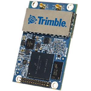
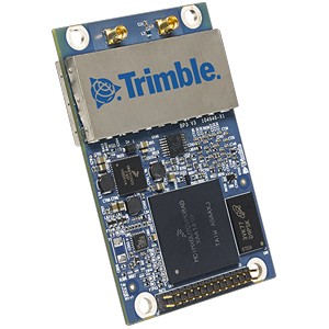
Trimble MB-TWO
Spécifications
|
|

|
Produit en fin de vie.
Modèle actuel : BD992 ou BD992-INS
High performance compact OEM module
Trimble MB-TWO
The Trimble® MB-Two is versatile, powerful, compact and smart.
The Trimble MB-Two provides faster Dual Frequency based Heading acquisition
and an improved positioning engine with additional GNSS signals.
In addition two MB-Two modules may be used for Precise Platform Position (P3)
using data from three antennas for full GNSS attitude.
|

|
Key Features:
- Precise Heading + Pitch/Roll
- Improved Dual Frequency Heading
- Dual Core Engine with Z-Blade Technology
- Precise Platform Positioning (P3)
- Web User-Interface
- Correction Services:
- Trimble® CenterPoint® RTX for sub 4 cm accuracy
- Trimble® RangePoint® RTX for sub 50 cm accuracy
- Superior Connectivity
- Ethernet, USB 2.0, Serial Ports (LVTTL)
- Small Form Factor
- Low Power

|
RTK/ PPP heading in a single OEM module
The Trimble MB-Two is the successor to
the Trimble MB-One OEM receiver module.
The MB-two maintains the identical
form-factor as its predecessor and offers
customers a drop-in replacement to
utilize the latest GNSS design innovations.
Versatile, powerful, compact and smart,
the Trimble MB-Two provides faster dualfrequency-based
heading acquisition and
an improved RTK/PPP positioning engine
with multiple GNSS signals. In addition, two
MB-Two modules can be easily connected
to each other to build a Precise Platform
Positioning module (no firmware upgrade
required), utilizing up to four dual-band
GNSS antennas for multisensory raw
data output, precise position and attitude
simultaneously.
The MB-Two allows a wide range of optionupgradable
GNSS configurations from
single antenna/frequency (GPS) to dual
antenna/frequency (GPS, QZSS, GLONASS,
Beidou, Galileo). Ashtech’s patented
Z-Blade technology drives a powerful GNSS
agnostic engine allowing MB-Two to use any
single GNSS system for positioning (or any
combination of them) without relying on
GPS. The GNSS engine utilizes over-the-air
satellite corrections via embedded L-band
hardware to achieve centimeter/decimeter
level accuracy with PPP Trimble™ RTX
corrections removing the dedicated base
station/Network and communication link.
|
Dual atenna / sensor
- Heading + Pitch/Roll
- Accurate/Fast Heading using dualfrequency multi-GNSS algorithms
- Dual GNSS sensor raw data with common clock
- Single board for RTK/PPP and heading simultaneously
Powerfull RTK engine
The MB-Two has a powerful RTK engine
that delivers centimeter-level accuracy
for systems using corrections from a local
base or an RTK network. It also features
RTK against a moving base for relative
positioning. The network RTK capabilities
include third-party network corrections
such as VRS, FKP, and MAC. When two or
more alternative RTK correcting data are
available, MB-Two runs the Ashtech Hot
Standby RTK algorithm allowing it to use
them simultaneously in the positioning
process
Next generation hardware design
- Low power consumption in a compact size
- Dual-core CPU for optimal performance
- Web User Interface for ease of use and evaluation
- Two tightly integrated dual-band GNSS engines
- L-band RF/digital with up to two MSS channels
|

|
TECHNICAL SPECIFICATIONS
GNSS ENGINE
- 240 Tracking Channels
- Two tightly coupled, all-in-view GNSS sensors delivering simultaneously:
- GPS L1+L2
- QZSS L1+L2
- BeiDou B1+B2
- GLONASS G1+G2 FDMA1
- GALILEO E1+E5b
- SBAS L12
- 2 x MSS L-Band Tracking Channels
FEATURES
- Ashtech patented Strobe Correlator™ to reduce GNSS multi path
- Ashtech patented Z-tracking to track encrypted GPS P(Y) signal
- Ashtech patented Z-Blade technology to process multi-GNSS data
- GPS-only, GLONASS-only or BeiDou-only solutions possible (from Autonomous to RTK)
- Fast Search Engine to improve TTFF
- Position in local datums and projections with RTCM-3 transformation data
- Trimble RTX™ PPP engine
- Ashtech Hot Standby RTK Algorithms
- Ashtech Flying RTK Algorithms
- Full attitude engine with two MB-Two boards connected
- RTK with Static & Moving Base corrections supported
- Heading engine with optional baseline length self-calibration
- Multi-dynamic mode (static/moving Base and Rover functions simultaneously)
- Adaptive velocity filter to meet specific dynamic applications
- Up to 250 MB of internal memory for data logging; on-board memory for various
applications
- Up to 50 Hz position/velocity/heading/observables output3
- Reference Inputs/Outputs: RTCM 3.24, RTCM2.3, CMR/CMRx 5, ATOM6
- RTK Networks Supported: VRS, FKP, MAC
- Navigation Outputs: NMEA-0183, ATOM
- One-push Ashtech Trouble Log (ATL)
- Programmable startup protection
GNSS SENSOR PERFORMANCE
- Time to First Fix (TTFF):
- Cold start: < 60 seconds
- Warm Start: < 45 seconds
- Hot Start: < 11 seconds
- Signal re-acquisition: < 2 seconds
- Position accuracy (HRMS), SBAS: 0.50 m7
- Update rate: Up to 50 Hz
- Latency: < 10 s 8
- Velocity Accuracy: 0.02 m.sec HRMS
- Maximum Operating Limits19:
PRECISE POSITIONING PERFORMANCE RTK9, 10, 11
- L1 only (fixed ambiguity)
- Accuracy (HRMS): < 12 mm + 1.5 ppm
- Initialization time: < 10 min typical
- Operating range: < 10 km
- L1/L2 (fixed ambiguity):
- Accuracy (HRMS): < 8 mm + 1 ppm
- Initialization time: < 1 min typical
- Operating range: > 40 km
RTX12, 13
CenterPoint
- Accuracy (H95): 4 cm
- Initialization time: < 30 min. typical
- Operating range (inland): Almost unlimited
RangePoint
- Accuracy (H95): < 50 cm
- Initialization time: < 5 min.
- Operating range (inland): Almost unlimited
|
HEADING 10, 14, 15
- Accuracy (RMS): 0.2° per 1 m of baseline length
- Initialization time: < 10 sec typical
- Baseline length: <100 m
I/O INTERFACE
- SAMTEC 28 Pin I/O Connector (TMM-114-03-G-D)with backward compatibility for
current industry standards
- 3 x LVTTL (UART types) serial ports allowing up to 921,600 bps
- USB 2.0 OTG port allowing up to 12Mbps (USB/Serial Link, USB Memory Stick,
Onboard Memory Access)
- CAN bus interface (hardware ready)
- 1 PPS out / Event In
- 1 LAN Ethernet port
- Supports links to 10BaseT/100BaseT networks
- All functions are performed through a single IP address simultaneously-including
web GUI access and raw data streaming
- Network Protocols supported
- HTTP (web GUI)
- NTP Server
- NTripCaster, NTripServer, NTripClient
- Dynamic DNS
PHYSICAL AND ELECTRICAL CHARACTERISTICS
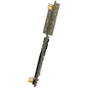
- Size : 71 mm x 46 mm x 11 mm
- Power : 3.2 to 4.5 V DC
- Power Consumption16 : <1.2 Watt
- Weight : 24 grams
- Connectors
- I/O : 28 pin dual-row male header
- Antenna : 2 x MMCX female connectors
- Antenna LNA Power Output
- Input Voltage Range : 4.0 to 12.0 V DC on I/O connector pin 517
- Maximum current : 150 mA
- Minimum current : 5 mA
- LNA Gain Range (minus signal loss) : 17 to 37 dB
ENVIRONMENTAL CHARACTERISTICS18
- Operating Temperature : –40 °C to 85°C
- Storage : –40 °C to +70 °C
- Vibration : MIL-STD 810F, Fig. 514.5C-17
Random 6.2 gRMS operating
Random 8 gRMS survival
- Mechanical Shock : MIL-STD 810F, Fig. 516.5-10
(40g, 11ms, saw-tooth)
- Operating Humidity : 95% non-condensing
- Maximum Acceleration : 11 g
RECOMMENDED ANTENNAS
- Compact GNSS Machine/Marine/Aviation Antennas: Trimble AV33 & AV 34
- GNSS Machine/Marine/Aviation Antennas: Trimble AV59 & LV 59
ORDERING INFORMATION
- Module Part Number : 106960-XX
- Module : Trimble MB-Two available in a variety of
configurations from SBAS upwards
- Evaluation Kit : Includes interface board and power supply
|
1. Hardware ready for G1 and G2 CDMA. This is based on the assumption that these new signals will be transmitted
within natural GLONASS L1, L2 or within GPS L1/L2 frequency bands.
2. In some modes, SBAS L1 is available only for single sensor.
3. At 50 Hz, a limited set of messages can be generated simultaneously through a single port.
4. RTCM-3.2 Multiple Signal Messaging (MSM) guarantees compatibility with 3rd party for each GNSS data.
5. A Trimble proprietary format. CMRx output is not supported.
6. ATOM: Open Ashtech format.
7. VRMS for Autonomous/SBAS positions are usually twice as high as HRMS.
8. Heading latency is usually twice as high.
9. VRMS = 2 x HRMS
10. Accuracy and TTFF specifications may be affected by atmospheric conditions, signal multipath, satellite geometry
and corrections availability and quality.
11. Same for single base and network.
12. Requires L1/L2 GPS+GLONASS at a minimum.
13. Accuracy and TTFF specifications may be affected by atmospheric conditions, signal multipath, satellite geometry and
L-band service availability. Trimble RTX correction services are only available on land.
14. L1/L2 data required.
15.Figures of pitch accuracy are twice as high.
16. Typical power consumption for single antenna L1 GPS/GLONASS.
17. This will be used if greater than the main power input voltage.
18. Dependent on appropriate mounting / enclosure design
19. As required by the U.S. Department of Commerce to c
Haut de la Page
GPS Gamme complète
GPS Polyvalents -
GPS Aviation -
GPS Marine -
GPS Cartographie -
Les Logiciels
[GPS Portables et Fixes]
[OEM Composants]
[Localisation et Suivi de véhicules]
[Applications Professionnelles]
|


